
Batavia
Batavia was founded by the Dutch East India Company (VOC) in 1619 on the site of the Javanese port of Jayakarta and became the administrative centre of Dutch power in Asia. From its position on the north coast of Java, the city controlled the VOC’s commercial network across the East Indies and served as the principal headquarters for Dutch trade, navigation, and colonial administration.
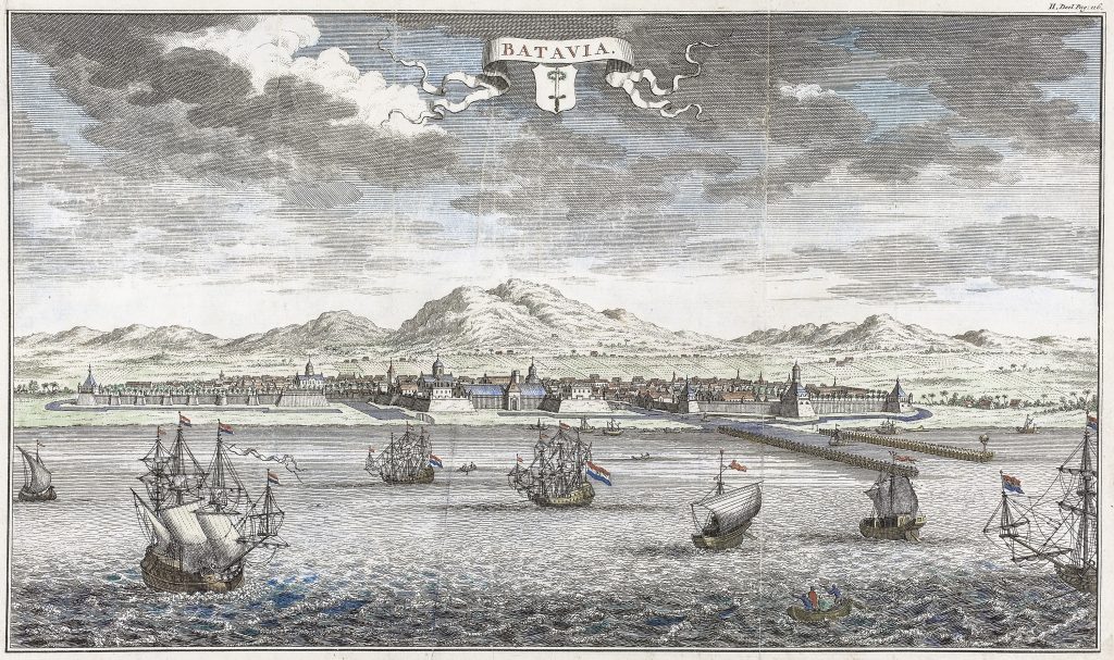
This engraved view presents Batavia from the sea, emphasising the city's maritime identity. Dutch East India Company vessels and smaller craft occupy the foreground, while the fortified city extends across the shoreline behind them. The walls, bastions, churches, warehouses, and harbour works are carefully arranged to convey both the scale of the settlement and the security of its anchorage. Beyond the city rise the mountains of the Javanese interior, providing a dramatic backdrop and reinforcing the contrast between the ordered colonial settlement and the surrounding landscape. The composition celebrates Batavia as a centre of maritime commerce. The numerous Dutch ships flying the States flag draw attention to the city’s role as the hub of a trading network extending from Europe to Asia. Rather than depicting everyday urban life, the view focuses on the harbour, shipping, and defensive works that underpinned the VOC’s commercial success.
The page reference “II. Deel Pag. 116” indicates that the engraving was published as an illustration within the second volume of a Dutch text. Such views were commonly included in travel accounts, geographical works, and histories of the Dutch East Indies, where Batavia was presented as the principal European city in Asia and the centre of Dutch overseas power. See Rijksmuseum here
Within the collection, this view is closely connected with the plans and charts of Batavia and its harbour (190and 472), which show the city from complementary cartographic perspectives and illustrate its importance within the Dutch maritime world.
Anonymous
unidentified Dutch publication, vol. 2, p. 116
c. 1700–1799
Copperplate engraving
191