
Nieuwe Kaart van Banda
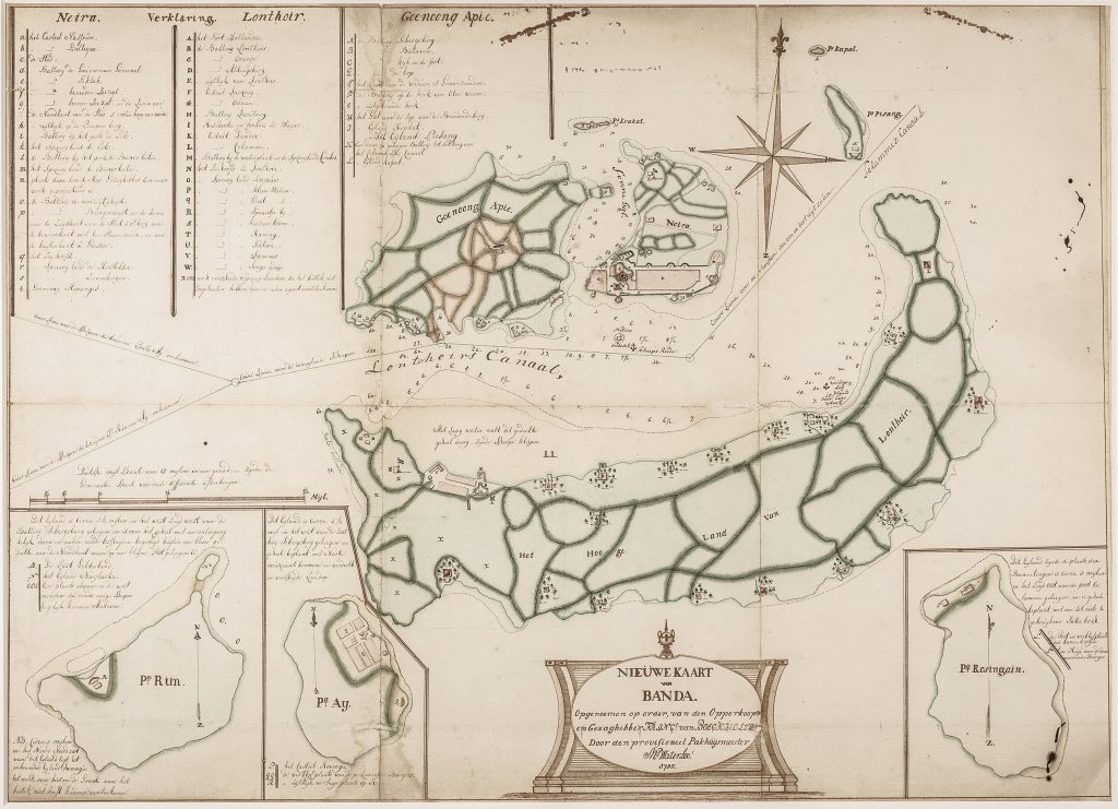
This manuscript map showcases three key Banda Islands: Banda Api, known for its volcano Gunung Api (or "Burning Mountain"); Banda Neira; and Banda Lonthoir (modern-day Banda Besar). It also includes name tables and three insets depicting the smaller islands of Run, Ay, and Rosingain (now Hatta). The map offers a detailed portrayal of key locations, topographical features, anchorage points, gun batteries, and other significant geographical landmarks.
Situated in present-day Indonesia, the Banda Islands were historically renowned for their abundant production of nutmeg, mace, and cloves—highly sought-after commodities that fueled intense colonial competition. By the late 18th century, European powers fiercely vied for control of the region, seeking to dominate the profitable spice trade.
The inscription ain the cartouche reads: Nieuwe Kaart van Banda. Opgenoomen op order, van den Opperkoopmen Gezaghebber Franc van Boekcholster. Door den provisioneel Pakhuijsmeester Mr Waterloo 1795. (New Map of Banda. Surveyed by order of the Senior Merchant and Governor Franc van Boekcholster. By the provisional Warehouse Master Mr. Waterloo, 1795)
Waterloo, Anthonie (1609–1690)
1795
Manuscript
124
Only copy