
India tercera nova tabula
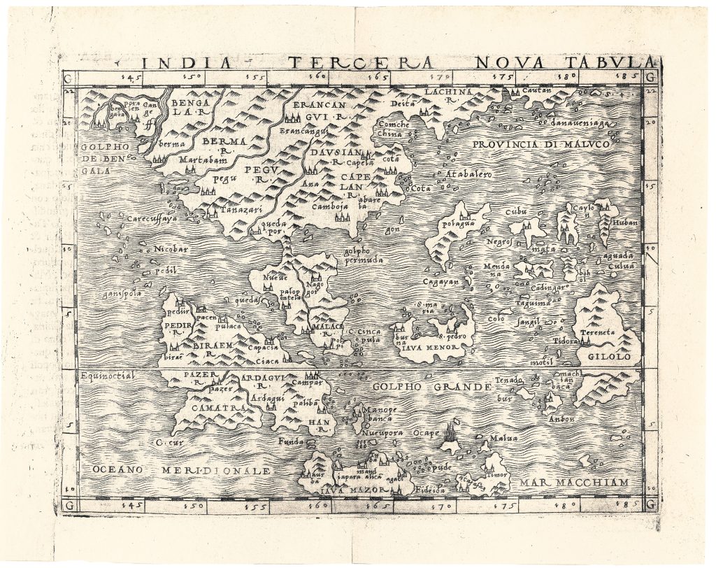
Giacomo Gastaldi was one of the most important Italian cartographers of the mid-sixteenth century, and his work played a central role in reshaping European ideas about Asia and the East Indies. India tercera nova tabula was the first of three important Southeast Asia maps associated with Gastaldi in this period. It was published in 1548 in Pietro Andrea Mattioli’s Italian translation of Ptolemy’s Geographia. A second map of the region appeared in 1554 in Giovanni Battista Ramusio’s Delle navigationi et viaggi (28, 352), and a third was included in Gastaldi’s separately published map of Asia in 1561.
The map extends from the Bay of Bengal in the west to the Moluccas in the east, and from southern China in the north to Java and the seas south of the archipelago. Unlike the Ptolemaic Southeast Asia map, this is a modern regional map organised around coasts, islands, trading centres, and sea routes. Sumatra, the Malay Peninsula, Java, Borneo, the Philippines, Gilolo, Ambon, Timor, and the Moluccas all appear, as do important mainland regions such as Bengal, Burma, Pegu, and Cambodia. The map’s emphasis is decisively maritime.
Gastaldi compiled the map from several contemporary sources, including his own world map of 1546, the travels of Ludovico di Varthema, and information associated with Ferdinand Magellan's voyage, particularly for the East Indies and Philippines. One notable feature visible on the map is the erupting volcano labelled Ocape, northwest of Timor. Thomas Suarez identifies this as Gunung Api, or “fire mountain, ” a descriptive Malay name for a volcanic island. Such details show the map’s close engagement with recent navigational and travel knowledge.
Within the collection, this map is closely connected with Gastaldi’s Ptolemaic Tabula Asiae XI (58), since the two were published together in the same 1548 atlas but present very different conceptions of the region. It should also be compared with Gastaldi’s later Ramusio Southeast Asia maps (28and 29), which developed similar regional material within the framework of Venetian travel literature rather than a Ptolemaic atlas.
Gastaldi, Giacomo (d. 1566)
Pietro Andrea Mattioli, trans., La geografia di Claudio Ptolemeo alessandrino, Venice: Giovanni Baptista Pedrezano, 1548
1548, first
Copperplate engraving
57
R4 Common - often seen on the market