
A new chart of New Holland
This work has often been attributed to William Eden because his Principles of Penal Law appears in the preface, but the author is unknown. Published in 1787, on the eve of the departure of the First Fleet for New South Wales, the book compiled earlier European accounts of New Holland at the moment it was being selected as the site of a British penal colony. The interest lies in the author's preface, listing convict ships and its promotion of Botany Bay; it deals directly with the plan for settlement at Botany Bay, discussing new possibility of discoveries in natural history, and converting the natives, 'who were never found to possess a single trace of religious worship...'
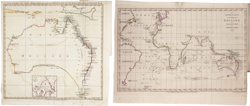
The volume contains two folding maps engraved by John Andrews (see also 173). The first presents New Holland with Cook’s east coast discoveries combined with earlier Dutch coastal surveys. The southern coastline remains conjectural, shown as a dotted line linking Pieter Nuyts’s discoveries with those of Abel Tasman. The second map traces the intended voyage of the First Fleet to Botany Bay.
As both a compilation of earlier sources and a publication tied to a specific historical moment, the book records the transition from speculative geography to active colonisation.
Unknown
London: Printed for J. Stockdale, 1787
1787, first
Letterpress
48
R3 Uncommon - dealers can usually obtain a copy