
Totius orbis cogniti universalis descriptio
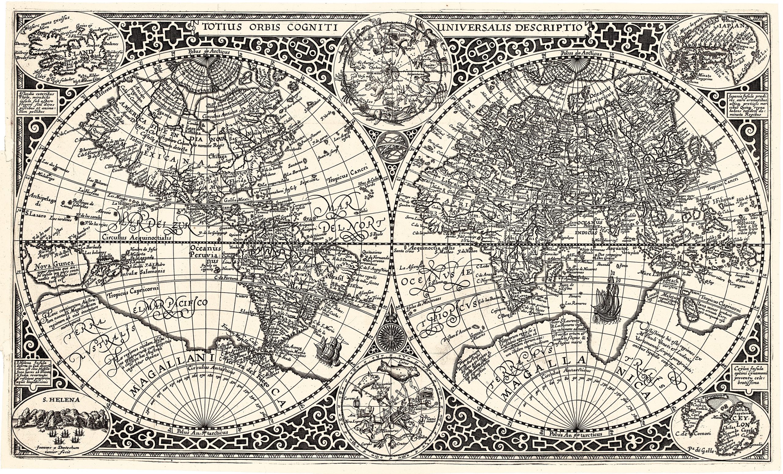
Paulus Merula, a distinguished scholar from Leiden and chief librarian at the University Library of Leiden, was well-versed in history, geography, law, and classical studies.
In 1605, two years before his death, he published his Cosmographia generalis, featuring a world map engraved by Jan van Doetecum.
This map was based on an earlier version by Jan's father, Baptista van Doetecum, for Petrus Plancius in 1590, but it included significant updates.
Among these were additions of the recently explored Nova Zemlya, mapped during Willem Barentsz's Arctic expeditions in search of the Northeast Passage, and two celestial hemispheres derived from Plancius's 1594 world map.
The map also features four keyislands: Japan, Iceland, Ceylon, and St.
Helena.
The map reflects the influence of Gerard Mercator’s cartography, particularly his rare 1595 map of the Polar Regions, by depicting four large Arctic islands and a clearly defined Northwest Passage, suggesting a route from the Pacific to the Atlantic via the Straits of Anian.
California and Quivira are labeled, accompanied by annotations on Christopher Columbus's discovery of America in 1492, as well as notes on the known and unknown northern regions of the continent.
A vast southern landmass, labelled Magellanica, Terra Australis, and Tierra del Fuego, is prominently shown.
This depiction predates the expedition of Jacob Le Maire and Willem Schouten, which challenged the prevailing belief that the strait discovered by Ferdinand Magellan was the only waterway between the Atlantic and Pacific Oceans in the Southern Hemisphere.
The map also shows a large Nova Guinea, with no sign of modern discoveries in Australia and New Zealand, retaining speculative details from Marco Polo's accounts, including his mention of "Beach".
Merula, Paulus (1558–1607)
Cosmographiae generalis.Leiden:Ex officina Plantiniana Raphelengij, 1605
1605, First
Copperplate engraving
59
R2 Very rare - one or two copies appear on the market